
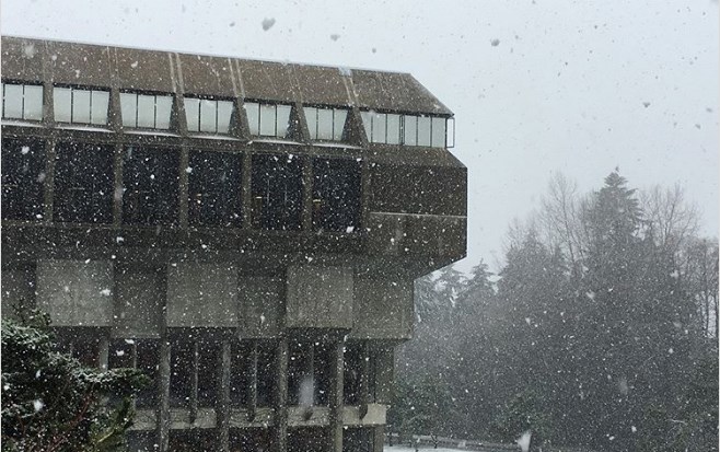
While we’ve been getting what feels like an endless dumping of rainfall in Metro �鶹��ýӳ��these past few days, local mountains have been getting it in the form of the colder white stuff. But that snow could make its way down to sea level by the end of this week.
��
Already on Thursday afternoon we have been getting wet flurries in the Metro �鶹��ýӳ��area, though for many in the city’s core it’s rain by the time it hits the umbrella.
that Thursday night the rain snow mix will be likely in “North �鶹��ýӳ��and higher terrain around the lower mainland including the Tri-Cities.”
��
That spotty, wet snow trend will continue into Friday at higher elevations, and there’s always the chance it will make it down in the form of wet flurries in Vancouver.
Similarly, is looking at the region getting wet flurries at higher elevations and continued rain at lower elevations.
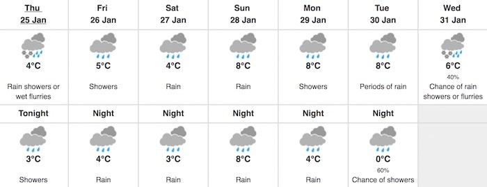
“Through Saturday afternoon the risk of wet snow for parts of the Fraser Valley exists, along with North �鶹��ýӳ��as well. This will depend on the exact track of the low as it bisects Washington State and crosses Puget Sound during the day on Saturday,” continues The Weather Network.
By Sunday, it’s looking like it’s all a wash…as in we are going to get more downpours. This most rain, perhaps some wet snow vibe continues on into next week, too, as the calendars turn to February.


